Not so long ago, keeping track of every trap and bait station meant notebooks and spreadsheets. Today, most of our volunteers carry the whole conservation area in their pocket, thanks to the TrapNZ app.
TrapNZ maps our boundary, our tracks and every trap and bait station along them. Each device has its own code. "A100-200", for example, tells us it is trap 10 on the A line and that it is a DOC 200 trap.
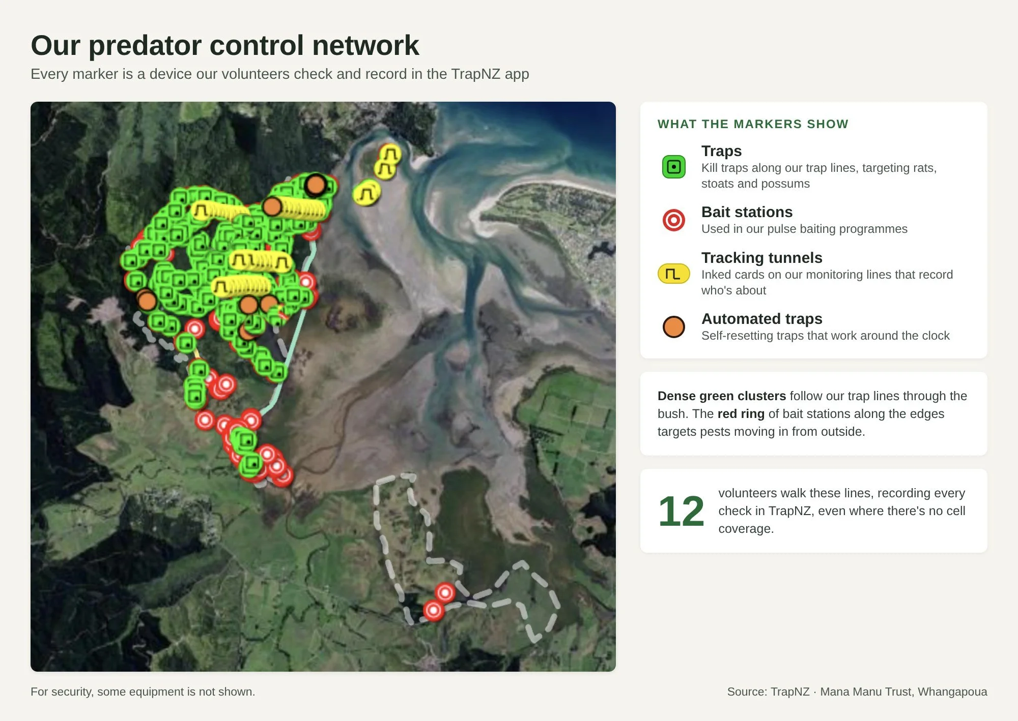
Out on the trapline, volunteers record each check straight into their phone. Did the trap catch something? Which species? Was the bait fresh, replaced or missing? They can even add a photo. For bait stations, they record how much bait went in, how much was eaten and how much was removed at the end of the programme.
"It's been a game changer for us, not having to use spreadsheets," says Predator Control Coordinator Eric Hamilton. The app collates everything automatically, so we can track catches month by month and produce reports.
Those reports are already shaping our work. Bait uptake is highest around our perimeter, which tells us that is where pest pressure comes from. When we cleared one inner bait station recently, most of the bait was untouched – good news about rat and possum numbers in the centre.
We also use TrapNZ for tracking tunnel results, five-minute bird counts and mapping special features such as rātā trees. No cell coverage on the trapline? No problem. The data uploads once you are back in range.
About 12 of our volunteers trap and bait for the trust. Eric's advice to other groups is to invest in training: "Spend time getting your people to understand how to use it." The challenge is rarely resistance – more often it is simply unfamiliarity with digital tools.